Heʻeia NERR Logo

Heʻeia National Estuarine Research Reserve Site Profile

Administrative Overview

I. Mission, Site Description, Inclusive of Human Dimensions, & Lead Agency Info

Mission

To practice and promote stewardship through Native Hawaiian philosophies and values. Our efforts are supported by Indigenous knowledge, innovative research, education, and training that nourishes healthy and resilient ecosystems, economies, and communities.

Chapter 1: Reserve Introduction

This section covers administrative information, an introduction to the Reserve and an overview of the Estuary.


You will find report summaries below as well as:
An Overview of Reserve Research Priorities A thumbnail image that links to Reserve priorities
An Interactive Reserve Habitat Map

Vision

The ahupuaʻa concept is a global example of a thriving and resilient social-ecological community. The biocultural integrity of the ahupuaʻa of Heʻeia is restored to a state of ʻāina momona and is a legacy for future generations.

ʻĀINA MOMONA - A Song Written by ʻĀnuenue Punua/Music, with video here composed and performed by Kāwika Kahiapo at the Paepae o Heʻeia 10th anniversary fundraiser

Lyrics

Hanohano O Heʻeia i ka ua nui

Halaulani, Kanikoʻo, Mololani

Kunihi paliʻuli o Iolekaʻa

Kaʻa maila na wai ola o uka nei

Hiaʻai kamanaʻo o ka ʻāina wehi

Manomano ke kalo kanu o ka ʻāina

Akahi no a ike ke pua o ka hau

Popohe mai nei au o Meheanu

Kiaʻi o loko na hana kupuna

Loko iʻa piha me ka ʻai kamahaʻo

Kamahaʻo o Heʻeia kaʻu i ʻike

He ʻāina momona no na kau a kau

Translation

Magnificent is Heʻeia with it's great rain

Halaulani, Kanikoʻo, Mololani

Lush and prominently stands Iolekaʻa

Providing life giving waters from above

Thoughts delight of its verdant lands

Filled with taro fields

The flowering of the hau has been seen

When in full bloom Meheanu swims

Guarded are the works of our ancestors

Pond filled with wondrous foods

Wondrous is Heʻeia

An abundant land for lasting generations

Site Description

The Heʻeia NERR is located in the moku (social-ecological region) of Koʻolaupoko and ahupuaʻa (social-ecological community) of Heʻeia, on the northeastern or windward shore of the mokupuni (island) of Oʻahu. The ahupuaʻa is one of nine surrounding Kāneʻohe Bay, also known as Ka Waha o ka Manō (the mouth of the shark). Heʻeia plays a prominent role in the history and mythic origin stories of Hawaiʻi. The name Heʻeia means “washed away,” a reference to a giant wave that swept two battling armies out to sea. After making an offering and prayers while floating at sea, the army of Haumea and Wākea, primordial ancestors of the Hawaiian people, was set ashore and saved. Haumea named her adopted grandson Heʻeia, and the ahupuaʻa is named for him (Rose and Klieger).

A photo of the Heʻeia Fishpond. Photo by Michelle Mishina, pilot Nick Greun, January 2022.

Figure 1: The Heʻeia Fishpond was listed on the National Register of Historic Places (50-80-10-327) in 1973. The kiaʻi (guardian) of Heʻeia Fishpond, Meheanu, lived in a section of the wetland in the lower left of the photo, called Luamoʻo. She had the power to change herself into a moʻo (lizard) or a puhi (eel), depending on the color of the hau (hibiscus) thickets (See moʻolelo on Meheanu). Photo by Michelle Mishina, pilot Nick Greun, January 2022.

Image depicting the Heʻeia wetlands. Photo credit: Michelle Mishina, pilot Nick Greun, January 2022.

Figure 2: Heʻeia ahupuaʻa, containing the peaks of Iolekaʻa in the center and Keahiakahoe on the left. The image depicts the Heʻeia wetlands, Heʻeia Stream, and mauka portion of Heʻeia Fishpond. Photo credit: Michelle Mishina, pilot Nick Greun, January 2022.

Heʻeia is bounded by the ahupuaʻa of Kahaluʻu to the north and by Kāneʻohe to the south. The stunning Koʻolau cliffs at its mauka (upland) end rise to Puʻu Keahiakahoe and Puʻu ʻIolekaʻa, and contain heiau (places of worship), and burial caves. The valleys of Haʻikū and ʻIolekaʻa at the base of the mountains are rich in springs and streams, which irrigated hundreds of acres of loʻi kalo (taro ponds). The gods Kāne and Kanaloa, whose many forms include surface and groundwater, respectively, are said to have created a spring called Kapuna, and the abundant fresh water irrigated loʻi kalo in Haʻikū. In neighboring ʻIolekaʻa valley is a pool associated with the legendary rat called ʻIolekaʻa (rolling rat) (Cruz and Hammatt 2012). Haʻikū and ʻIolekaʻa Streams merge to form Heʻeia Stream, which flows through the wetlands of Hoi.

Two small ridges, Puʻu Māʻeliʻeli and Puʻu Pahu, mark the boundaries of the ahupuaʻa on the north and south side of the lowlands. The muliwai, or estuary, forms where Heʻeia stream meets Kāneʻohe Bay. Within the estuary and atop the fringing reef known as Malaukaʻa sits the 800-year-old Heʻeia Loko Iʻa (fishpond). Heʻeiaʻs boundaries extend into the bay, encompassing the islets Moku o Loʻe and Kekepa, and the northern end of Mōkapu peninsula. The ocean-facing side of the peninsula of Mōkapu (sacred land) contained fishing koʻa (shrines) (Cruz and Hammatt 2012).

The Heʻeia estuary is one of many estuaries in Kāneʻohe Bay, the largest sheltered body of water in the Hawaiian Islands, with a total surface area of 18 square miles (11,000 acres). The Heʻeia NERRʻs 1,385 acres include the estuary, wetlands, forests, marine waters, and coral reefs in the lower portion of the ahupuaʻa. The wetlands and forests once supported a range of Indigenous agro-ecosystems, while 88 acres of the fringing reef were enclosed to support Indigenous aquaculture in the form of a loko iʻa. These linked biocultural systems supported food production and provided flood mitigation, sediment retention, and habitat for endemic species. Recovery of biodiversity and ecosystem functions involves removing invasive species and restoring wetland habitats, loʻi kalo, Indigenous aquaculture systems, and native agroforestry. People are part of the landscape through mālama ʻāina (caring for and actively managing land and sea) and kilo (systematic observation).

Nautical map of the Heʻeia estuary, photo credit: NOAA

Figure 3: The coastal waters of Kāneʻohe Bay, with its many, productive estuaries, once contained at least thirty loko iʻa, including Heʻeia Fishpond. NOAA Nautical Chart 19359

Lead Agency Information

Lead Agency Photo, Photo by Joshua Levy

Figure 4: Aerial photo of Moku o Loʻe. Credit: Joshua Levy, himb.hawaii.edu, n.d.

Within the ahupuaʻa of Heʻeia, Moku o Loʻe is a 28-acre islet that serves as a marine research facility of the Hawaiʻi Institute of Marine Biology (HIMB) under the University of Hawaiʻi at Mānoa. The islet is named for Loʻe, one of four siblings from Ewa who settled in Heʻeia. Loʻe is associated with a moʻolelo about resource sharing within the ahupuaʻa (see moʻolelo on Keahiakahoe).

Back to Top

II. Description of the NERRS Program and Significance of this Site in the System

The National Estuarine Research Reserve System

The National Estuarine Research Reserve System (NERRS) was created by the Coastal Zone Management Act (CZMA) of 1972, as amended, to augment the National Coastal Zone Management Program, which is dedicated to comprehensive, sustainable management of the nation's coasts.

The Reserve System is a network of protected areas representative of the various biogeographic regions and estuarine types in the United States. Reserves are established for long-term research, education, and interpretation to promote informed management of the nationʻs estuaries and coastal habitats. (Title 15, Code of Federal Regulations (CFR), Part 921.1(a)). The Reserve System currently consists of 30 reserves in 25 states and territories, protecting over 1 million acres of estuarine lands and waters.

Estuaries are biologically rich, economically valuable, and highly vulnerable ecosystems. The vision and mission of the Reserve System reflect the importance of these systems within our communities.

Vision: Resilient estuaries and coastal watersheds where human and natural communities thrive.

Mission: To practice and promote stewardship of coasts and estuaries through innovative research, education, and training using a place-based system of protected areas.

The program goals, per federal regulations (15 CFR 921.1(b)), outline five specific goals for the Reserve System:

  1. Ensure a stable environment for research through long-term protection of National Estuarine Research Reserve System resources;
  2. Address coastal management issues identified as significant through coordinated estuarine research within the system;
  3. Enhance public awareness and understanding of estuarine areas and provide suitable opportunities for public education and interpretation;
  4. Promote federal, state, public, and private use of one or more reserves within the system when such entities conduct estuarine research; and
  5. Conduct and coordinate estuarine research within the system, gathering and making available information necessary for improved understanding and management of estuarine areas.
Photo of the Heʻeia ahupuaʻa. Credit: Keliʻi Kotubetey, 2020

Figure 5: Photo of the Heʻeia ahupuaʻa. Credit: Keliʻi Kotubetey, 2020

Heʻeia NERR

Heʻeia National Estuarine Research Reserve (Heʻeia NERR) presents an opportunity to honor the past by using Indigenous resource management approaches, integrated with the contemporary principles of the NERRS, to support sustainable co-management of the Heʻeia estuary. The NERRSʻ vision of "resilient estuaries and coastal watersheds where human and natural communities thrive" is consistent with Indigenous philosophies that place humans and nature together in the same system. Many of the objectives and strategies that have been built into the Heʻeia NERR Management Plan intentionally weave together Indigenous knowledge and practices. Heʻeia NERR promotes reciprocal collaboration and co-production of knowledge with Indigenous Peoples of Local Communities, or IPLC (Winter et al. 2020), providing a model for current and future generations in Hawaiʻi, as well as within the Reserve System.

Co-management partners within the Heʻeia NERR:

  • Hawaiʻi Institute of Marine Biology Logo
  • Paepae o Heʻeia Logo
  • Kākoʻo ʻŌiwi Logo
  • Koolaupoko Hawaiian Civic Club Logo
Map of Heʻeia Partners
Koʻolau Foundation Logo
NOAA Office of Coastal Management Logo
Hawaiʻi Department of Land and Natural Resources Logo
Hawaiʻi Community Development Authority Logo
Back to Top

III. Research Facilities, Costs, Access, Process/Procedures

The lands and waters within the Heʻeia NERR are co-managed by community-based non-profit organizations and state entities. Each co-management partner makes management decisions for the area within its lease or purview, and consults the other partners and the NERR about trans-boundary issues. Explore the main activities of each co-management partner below, and read more about each on their websites. For more about research facilities, costs, access, and other processes and procedures, see the Reserve Management Plan.

Visiting the Reserve

To visit our Reserve, please visit each of our co-management partner websites and inquire with your interest. Below are points outlining specialized activities at each of the partner sites. For more general information, please contact info@heeianerr.org

Hawaiʻi Institute of Marine Biology

  • Research on a broad range of topics in marine and aquatic biology
  • High school, undergraduate and graduate-level programs and training
  • Public visitor and school-based education programs

Kākoʻo ʻŌiwi

  • Restoration of loʻi kalo (flooded field systems), native wetlands, and agro-forests
  • Local and Indigenous food production
  • Public visitor, volunteer, and school-based education programs

Paepae o Heʻeia

  • Restoration of an 800-year old loko iʻa (aquaculture system) and muliwai (estuary)
  • Public visitor, volunteer, and school-based education programs
Back to Top

IV. Management Priorities for Research, Monitoring, Stewardship, Education

Research priorities in the Heʻeia NERR are determined through participatory meetings with our co-management partners to identify needs for restoration and management.

Heʻeia NERR Research Priorities

Hover over the images below for Research Questions

Historical Ecology

Research Priority Image for Historical Ecology. Photo by USGS

photo by USGS

Historical Ecology

What and when were the major ecological regime shifts in Hawaiʻi, how did these shifts affect ecosystem services, and how can historical ecology inform restoration and management of contemporary Hawaiian social-ecological systems?

How did Native Hawaiians adapt to changes in climate and subsequent effects on resources, and how can historical ecology inform current restoration from a resilience perspective?

Habitat Health

Research Priority Image for Habitat Health. Photo by Kelle Freel

photo by Kelle Freel

Habitat Health

How do water movement and water quality throughout the watershed affect habitat health in wetland, stream, coastal fishpond, and reef ecosystems?

What is the sediment input and nutrient dynamics into nearshore coral reef ecosystems?

What are the spacial and temporal variability of physical and biogeochemical processes at the foundation of healthy watersheds, including a thriving wetland, productive Hawaiian aquaculture systems, and diverse coral reef ecosystems?

How does restorationa and maintenance of agroforestry, wetland agro-ecology, and novel forest types affect water quality, erosion control, nutrient cycling, carbon sequestration, and other ecosystem services?

Biological Indicators

Research Priority Image for Biological Indicators. Photo by Sean Marrs

photo by Sean Marrs

Biological Indicators

What are the effects of indigenous resource management on native species richness and abundance within local-scale habitats in the context of Hawaiian social-ecological systems?

What are the bioindicators of watershed abundance and health, such as native birds, fishes, and plants?

How do we mitigate specific contamination by wastewater and invasive species?

Native Species

Research Priority Image for Native Species. Photo by Bryan Harry

photo by Bryan Harry

Native Species

How are the trophic interactions (e.g. food web dynamics) and the abundance and diversity of native and non-native species, especially those that serve as biological indicators of ʻāina momona (productive lands) changing in response to biocultural restoration?

How does the removal of terrestrial and/or marine invasive species affect ecosystem services and other indicators of healthy Hawaiian social-ecological systems, such as the presence of native biodiversity?

Well Being and Human Health

Research Priority Image for Human Health. Photo by Fred Reppun.

photo by Fred Reppun

Human Health
What are the sociocultural, educational, and economic aspects of ecosystem services, including biocultural indicators of human health and wellness at collective human scales?

How does restoration of Hawaiian social-ecological systems help to control microbial contaminants detrimental to human and animal health?

How can social-ecological metrics be used to evaluate and understand the impact of biocultural restoration on human health, wellbeing, and connection with nature?

What is the impact of ʻaina-based education programs on educational and economic outcomes at individual and community scales, and what practices, structures, and policies might extend that impact?

Circular Economies

Research Priority Image for Circular Economies. Photo by Justin Tang.

photo by Justin Tang

Circular Economies

How can indigenous resource management be adapted to contribute to robust and resilient community-based, circular economies in a modern context?

Climate Change

Research Priority Image for Climate Change. Photo by Shimi Rii.

photo by Shimi Rii

Climate Change

What are the effects of changing climate conditions (e.g., intesified storm events, sea-level rise, eitrophication, ocean acidification) on healthy habitat functioning and ecosystem services?

How does restoration of Hawaiian social-ecological systems promote resilience?

Management

Research Priority Image for Scalability of Indigenous Managament. Photo by Ciara Ratum.

photo by Ciara Ratum

Scalability of Indigenous Resource Management

How can indigeenous resource management and the restoration of Hawaiian social-ecological systems in Heʻeia address issues of conservation and sustainability in Hawaiʻi, and in other Pacific island or coastal systems?

Learn more about the Reserve's research priorities here

Blank Image With Link to Learn More.
Back to Top

Estuary Overview

I. Estuarine Type

The Heʻeia estuary and watershed contains various landscapes, including Uka, Lepo pohō, and Wai/Kai.

The Heʻeia Reserve is one of 30 areas in the National Estuarine Research Reserve System and is protected for long-term research, water-quality monitoring, education, and coastal stewardship. The University of Hawaiʻi Institute of Marine Biology, in conjunction with other local partners, manages the site on a daily basis. NOAA's Office for Coastal Management provides funding, national guidance, and technical assistance.

Heʻeia Land Divisions

The Heʻeia estuary and watershed contains various landscapes, including Uka, Lepo pohō, and Wai/Kai.

Heʻeia Land Divisions. Credit: National Tropical Botanical
                Garden, 2002.

Figure 6: Illustration of a Hawaiian ahupuaʻa within the moku system. Credit: National Tropical Botanical Garden, 2002

Uka: uplandsHawaiian Symbol for Uka (uplands)

Includes the forest environments in the upper watershed, near and around the streams that feed into lower elevation environments.

Lepo pohō: marshHawaiian Symbol for Lepo pohō (marsh)

Includes the marshlands, wetlands, and loʻi kalo, loko wai systems.

Wai/Kai: stream/ocean Hawaiian Symbol for Wai / Kai (stream/ocean)

Freshwater (wai) stream environments, springs, groundwater, as well as the estuarine environment that merges with the ocean (kai)

Back to Top

II. Estuarine Habitats

Habitats within Heʻeia NERR are represented in the High-Resolution Land Cover Map (Habitat Map) developed below, in collaboration with NOAA Office for Coastal Management. The Habitat Map was designed to provide a management tool for the Reserve. It provides snapshots of the site over time, and will be updated periodically to quantify change due to both anthropogenic and natural processes. The habitat data are used to guide land management activities (e.g., exotic vegetation removal, restoration) at the Reserve and will be used as a baseline for change analysis studies in the future.

This map was created based on 2017 and 2020 imagery products through NOAA's Coastal Change Analysis Program (C-CAP), and using a Worldview 2 satellite product. Due to the amount of change within the site, the 2017 and 2020 images were both included as layers to create this updated habitat map, sharpened to 0.37 m cell size resolution with quality assurance and quality control procedures outlined in the Map package along with land cover and Accuracy Assessment metadata reports. Data are available online at the CDMO homepage http://cdmo.baruch.sc.edu. More detailed information about the GIS dataset can be obtained from the Heʻeia NERR.

Back to Top

III. Ecological Significance

The various estuarine habitats within Heʻeia NERR are home to both native and non-native species, and support biodiversity and other ecosystem services. As one of the ahupuaʻa within Koʻolaupoko, healthy functioning of the Heʻeia ahupuaʻa impacts other ahupuaʻa within Koʻolaupoko, as indicated by the Indigenous resource management strategy of the moku system (Winter et al. 2018). The health and vitality of each ahupuaʻa in Koʻolaupoko significantly influences the organisms, food web structure, and resilience of Ka-waha-o-ka-mano. It is the Reserve's priority to promote sustainability and resilience of Heʻeia as part of Koʻolaupoko. In this way, Reserve activities and functions focus on the watershed, ahupuaʻa, and moku scales.

Habitats found in this reserve support important endemic species, including the federally endangered Hawaiian stilt (aeʻo), Hawaiian moorhen (ʻalae ʻula), Hawaiian coot (ʻalae keʻokeʻo), Hawaiian duck (koloa), and Hawaiian hoary bat (ʻōpeʻapeʻa).

Back to Top

IV. Demographics and Population Trends of Reserve Connected Communities

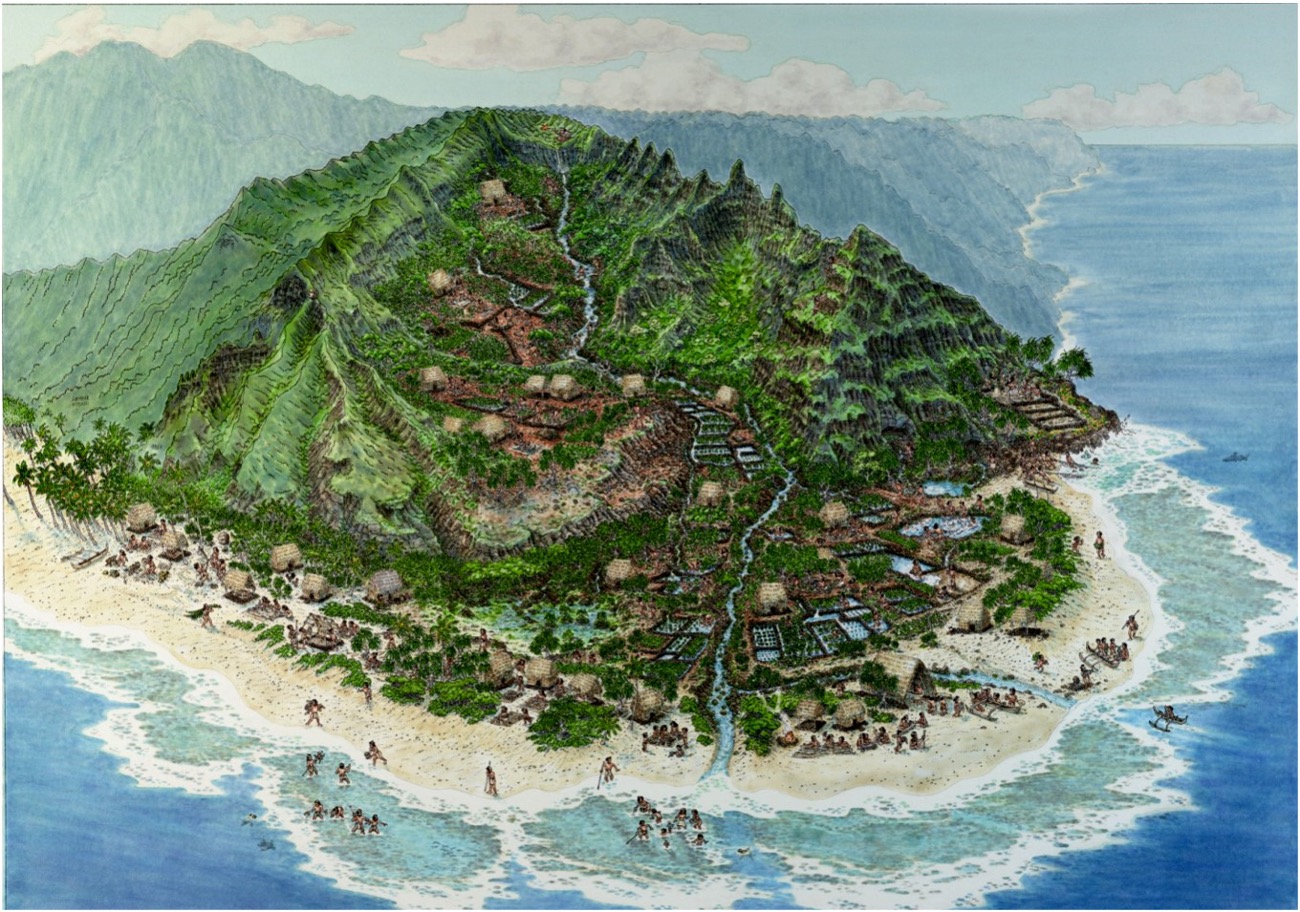
The Koʻolaupoko moku and, in particular, the ahupuaʻa of Heʻeia sustained a dense population (Cruz and Hammatt 2012) based on robust and flourishing agricultural and aquacultural resources. Owing to the frequent rainfall, abundant water resources, and fertile alluvial soil, Koʻolaupoko is known to have contained extensive early wetland agricultural complexes (Handy and Handy 1972). 
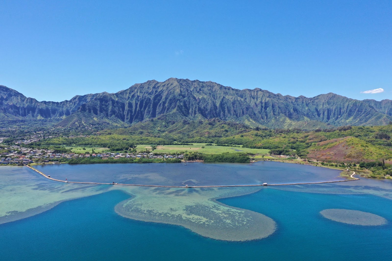
Of the nine ahupuaʻa surrounding Kāneʻohe Bay, Waiāhole and Waiheʻe are conservatively estimated to have contained 310 and 100 acres of loʻi, respectively, prior to 1778, while similarly large areas were cultivated in Kaʻalaea, Kahaluʻu, Heʻeia, and Kāneʻohe (Devaney et al. 1982). 
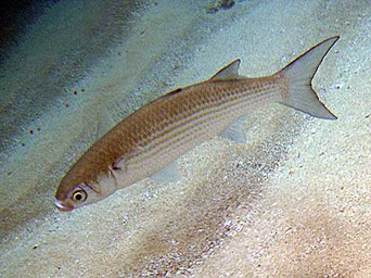
The Māhele (land division) records indicate that the area also included numerous shoreline fisheries, 
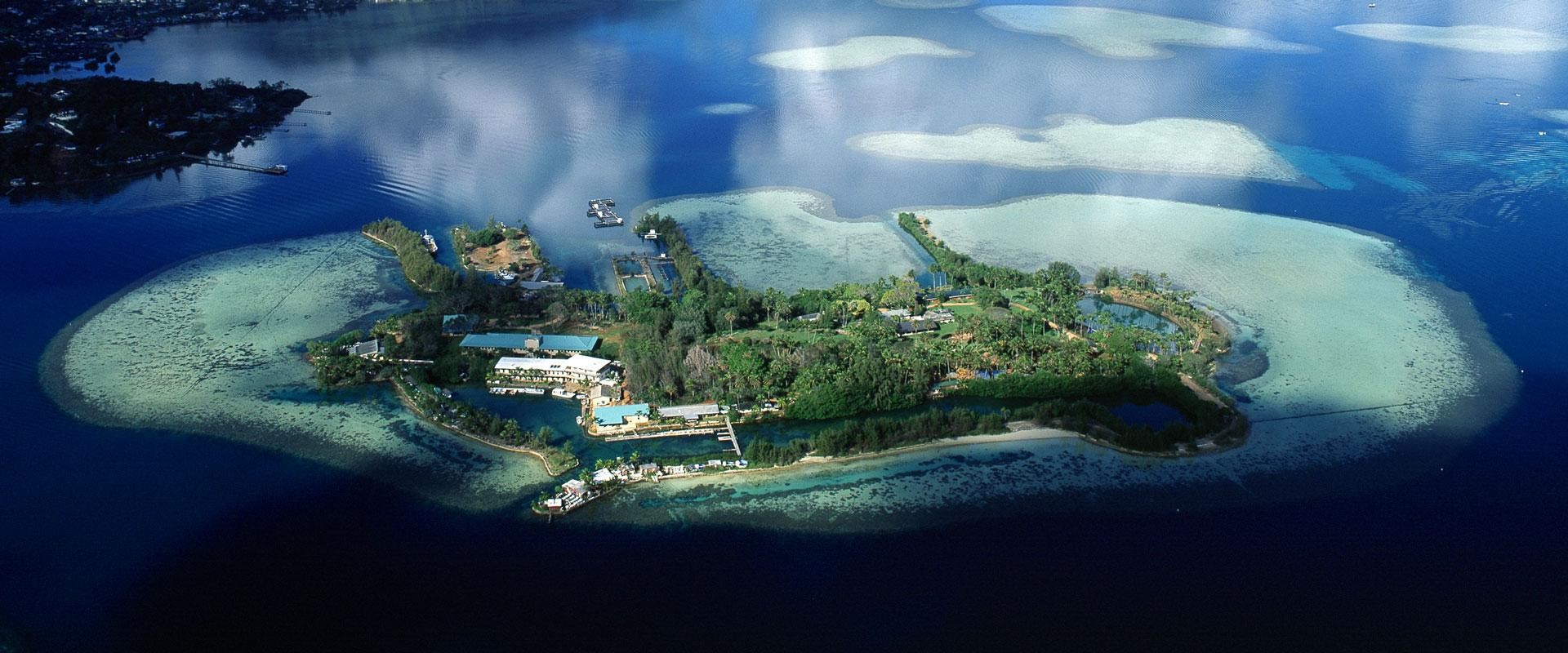
including at least 30 loko iʻa that spanned 30% of the shoreline in Kāneʻohe Bay (Devaney et al. 1982). Between the 1840s and 1850s, more than 60 land commission awards were issued for Heʻeia, reflecting the ability of this ahupuaʻa to support a vibrant and self-sustaining community.

The population of the area declined severely, as it did throughout the islands, following Western contact and colonization. Disease, land privatization, upheaval of traditional socio-economic systems, and migration to urban areas led to abandonment of agricultural and aquacultural resources, and paved the way for successive waves of commercial plantation ventures.

Koʻolaupoko, particularly the ahupuaʻa of Kāneʻohe adjacent to Heʻeia, became suburban after World War II, when tunnels and routes through the Koʻolau Mountains connected Kāneʻohe and Kailua with Honolulu. Residential construction took off in the 1960s. In the Heʻeia area, homebuilding peaked in the 1970s. Plans for further urban development in Heʻeia and valleys to the north were put forward in this period, but were opposed by Heʻeia and Waiāhole–Waikāne-area residents.

The Kāneʻohe Zip Code Tabulation Area (ZCTA) includes all the land surrounding Kāneʻohe Bay except for the Marine Corps base that occupies the Mōkapu Peninsula. As of 2013 the Kāneʻohe ZCTA contained 52,509 residents and 17,152 households. Compared to the demographic profile of the City and County of Honolulu the age structure of Heʻeia and surrounding areas is slightly older, with a median age of 41.5 years. Nearly all residents are Hawaiʻi-born, and the ethnic mix of the population is similar to that of the state as a whole. Detailed demographic characteristics of residents of the Kāneʻohe Zip Code Tabulation Area are shown in the Heʻeia NERR Management Plan.

Despite many changes over time, the people of the area maintain deep connections to the places where they 
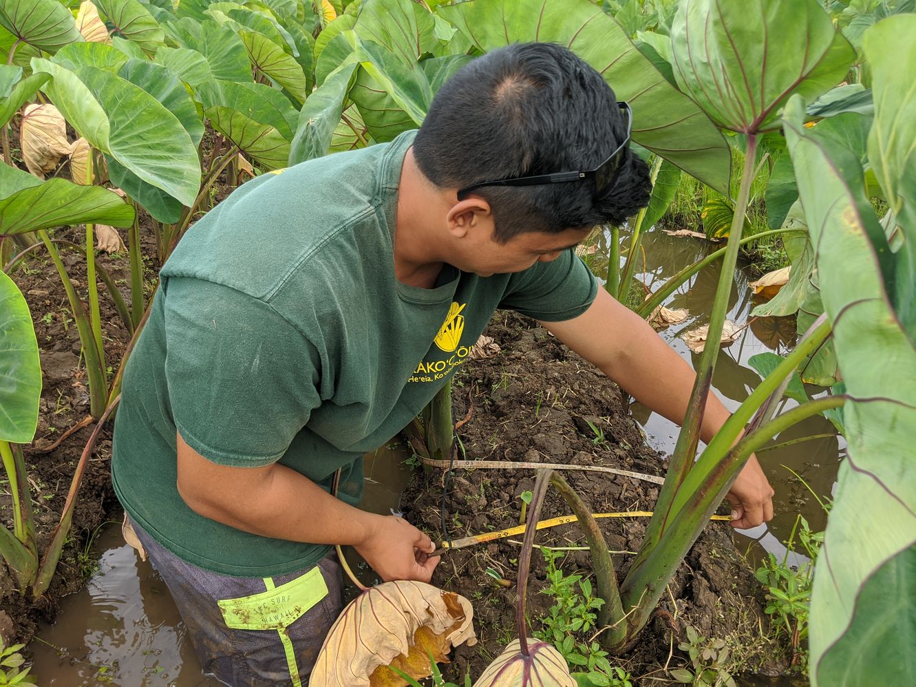
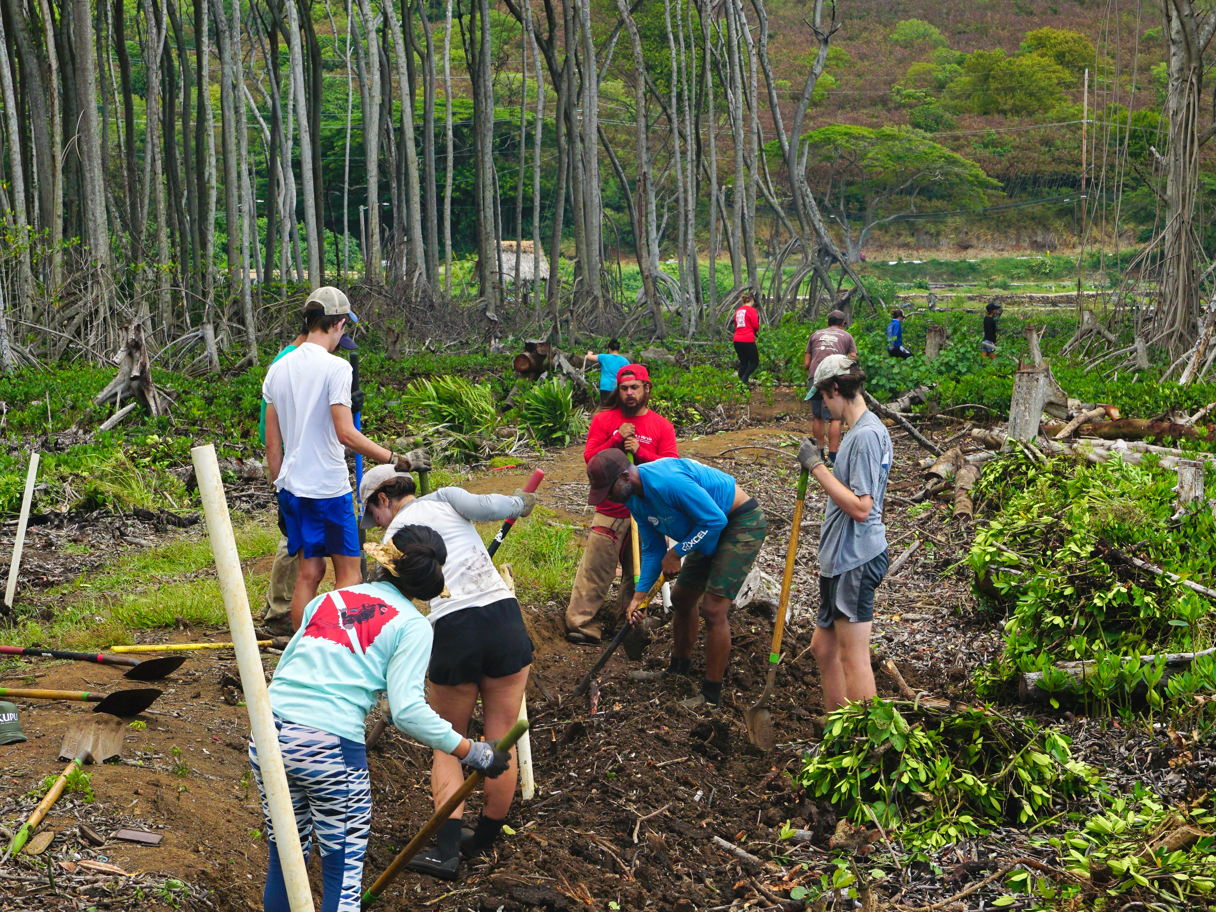
live, fish, hunt, farm, and recreate.

Glossary of Hawaiian Words

The ʻokina and the kahakō are diacritical markings that are part of the Hawaiian alphabet and used in Hawaiian words. The ʻokina, or glottal stop, is found only between two vowels or at the beginning of a word that starts with a vowel. A break in speech is created between the sounds of the two vowels. The pronunciation of the ʻokina in the word Kākoʻo is similar to saying “ka-koh-oh.” The kahakō is found only above a vowel. It stresses or elongates a vowel sound from one beat to two beats. The kahakō is written as a line above a vowel. There are differing pronunciations of some words depending on the area or island.

The glossary can be found here, and is always available in the side navigation menu that appears on all webpages included in the site profile.

Back to Top